us_state_capitals
U.S. state capitals and capitol building locations
Geographical coordinates and names of U.S. state capitals, transformed using scripts/us-state-capitals.py.
Includes latitude, longitude, state name, and capital city name for all 50 U.S. states.
Cities are represented as point locations of their capitol buildings using coordinates in the
WGS84 geographic coordinate system.
According to USGS
"Map services and data downloaded from The National Map are free and in the public domain. There are no restrictions; however, we request that the following acknowledgment statement of the originating agency be included in products and data derived from our map services when citing, copying, or reprinting: Map services and data available from U.S. Geological Survey, National Geospatial Program."
Fields
| Field | Type | Distribution | Summary | Missing |
|---|---|---|---|---|
lonAdd a description for lon | number | -157.9 – -69.78 · mean -93.47 | Missing 0 | |
latAdd a description for lat | number | 21.31 – 58.3 · mean 39.41 | Missing 0 | |
stateAdd a description for state | string | 50 distinct | Alabama 1 · Alaska 1 · Arizona 1 | Missing 0 |
cityAdd a description for city | string | 50 distinct | Albany 1 · Annapolis 1 · Atlanta 1 | Missing 0 |
Profiled across all 50 rows. No field descriptions yet. Add them
Explore
Preview
| lon | lat | state | city |
|---|---|---|---|
| -86.3005639 | 32.3777298 | Alabama | Montgomery |
| -134.4104388 | 58.3020694 | Alaska | Juneau |
| -112.097065 | 33.4482497 | Arizona | Phoenix |
| -92.2892284 | 34.746745 | Arkansas | Little Rock |
| -121.4935591 | 38.5765854 | California | Sacramento |
Examples
-
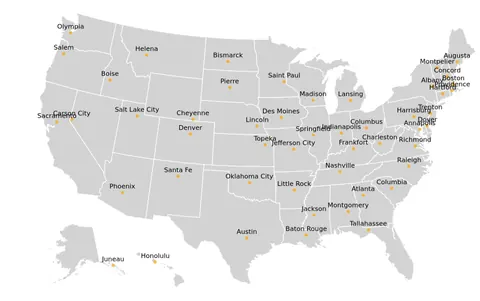 U.S. State Capitals Overlayed on a Map of U.S. Open in Vega Editor
 -
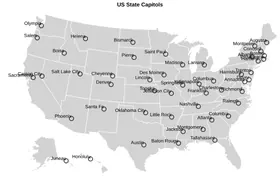 U.S. State Capitals Overlaid on a Map of the U.S Python Source
Vega and Vega-Lite examples open in the Editor with this dataset loaded. Altair examples link to their Python source.
Provenance
- Source
- License
-
- U.S. Public Domain (other-pd)
- U.S. Government Dataset (other-pd)
- File
data/us-state-capitals.json· 4,048 bytes · View on GitHub